

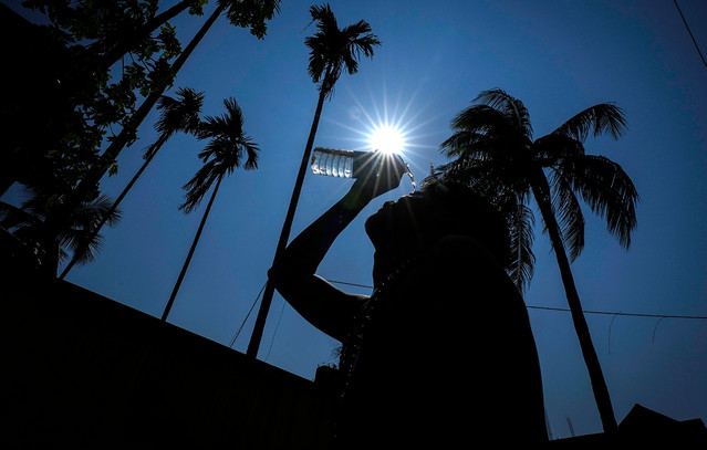
Athens will face more frequent and more intense heatwaves in the coming decades, with climate risk rising significantly across many parts of the Greek capital's metropolitan basin, according to the CLIMASPIN research project, which studied the effects of climate change on greater Athens and highlighted the need for urban planning to adapt to new climate conditions.
The study found that between 2031 and 2060, heatwave-related climate risk is expected to be markedly higher than during the 1981-2010 period, with the impact varying significantly between different areas of the city.
Kostas Kartalis, professor of environmental and climate physics at the National and Kapodistrian University of Athens, a member of the European Union's Scientific Committee on Climate Change and one of the project's lead researchers, said heatwave climate risk is already high in central Athens and in Elefsina, while it is classified as moderate in many parts of the wider Athens metropolitan area. He said that by 2031-2060, the risk is projected to intensify across all of Attica compared with 1981-2010.
Kartalis said the greater Athens metropolitan area, along with urban zones stretching to Elefsina and Megara, is projected to fall into the "very high risk" category. He noted a significant shift is also expected in the wider Mesogeia region, where risk is projected to rise by two full categories, from low to high.
How the risk is measured
Explaining the indicators used to assess heatwave climate risk and urban vulnerability, Kartalis said heatwaves cannot be approached through air temperature alone.
He said heatwaves are often defined solely by whether air temperature exceeds a certain value for consecutive days, but that modern scientific approaches go further. He said CLIMASPIN factored in indicators linking a given area, such as a city, to its specific climate characteristics, including cooling degree days, the number of heatwave episodes, average maximum summer temperature, hot days (days with a maximum temperature above 35 degrees Celsius) and tropical nights (days with a minimum temperature above 25 degrees Celsius).
Vulnerability, he said, is likewise not based on temperature alone but on a broader set of parameters determining how exposed residents of an area are during a heatwave.
Kartalis said it is not enough to consider only an area's temperature, but also a set of factors shaping vulnerability, such as how exposed a resident of an urban area is during a heatwave. He said these factors were incorporated through specific indicators including land surface temperature (which affects thermal comfort), the vegetation index, building density, building height, distance from urban green space, the share of the population aged over 65, and access to health services.
Linking climate change to urban planning
Kartalis said CLIMASPIN focuses on integrating climate change into spatial and urban planning, in line with European Union policy and the policies of several member states. He said this approach brings a significant benefit, since spatial planning that factors in climate change strengthens the resilience of areas to its effects.
According to the project's vulnerability findings, on a scale of 1 (very low) to 8 (very high), the highest current values are found in the greater Athens metropolitan area, in categories 6 to 8. Slightly lower values were also recorded in Elefsina and in urban areas of Mesogeia.
Kartalis noted that some areas have low vulnerability despite facing high heatwave climate risk, a pattern he said applies to several districts.
He explained this is due to how climate risk and vulnerability are defined and calculated separately. An area can be exposed to high heatwave risk while also having a high vegetation index, a relatively limited share of built-up surface, low or moderate building heights, short distances between residents and green space, and a high share of residents over 65, or some combination of these factors. In that case, he said, which he described as close to ideal for Athens, the risk is high but vulnerability is relatively limited.
Identifying vulnerable neighbourhoods
The research project also produced data covering the whole of Greece, allowing different indicators to be combined to identify areas where vulnerable population groups are concentrated alongside unfavourable environmental conditions.
Kartalis told the Athens-Macedonian News Agency that combining the vegetation index with a map of the population aged over 65 could show which areas have an elderly population more vulnerable to a heatwave. He said this can happen because an area with substantial or abundant greenery produces a significant cooling effect that reduces the thermal discomfort residents feel. He cited neighbourhoods in Kallithea, Galatsi and central Athens as examples where a larger elderly population coincides with limited vegetation, calling this important information for both urban planning and the health system.
He said the methodology's significance lies not just in documenting the problem but in serving as a tool for designing specific interventions. Kartalis said adaptation and resilience measures for heatwaves, whether for the present or the future, should not be designed around the spatial distribution of air temperature alone but in combination with climate risk and vulnerability. He said vulnerability data, examined by indicator individually or in combination, points to which policy interventions authorities should pursue. For example, if an area has low or moderate vulnerability because buildings are low-rise and building density is limited, the clear message is to avoid dense clusters of tall buildings. If an area has high vulnerability because vegetation is limited and residents must travel far to reach green space, the priority should be adding more green space and spreading it out. He noted that vulnerability is analysed at a resolution of 100 metres by 100 metres, or neighbourhood level, allowing targeted interventions across roughly 100 towns and cities in Greece.
Call for adaptation plans
Kartalis said one of CLIMASPIN's most important findings is its combined mapping of heatwave climate risk and vulnerability across greater Athens.
He said this points to an urgent need to draw up and implement climate adaptation plans that are not based on temperature alone, are not fragmented by municipality, since heatwaves do not respect administrative borders, and are instead coordinated by a single body so that combined measures reinforce one another's effectiveness. He said such plans have been significantly delayed, with few exceptions.
Kartalis also stressed the need to connect urban planning with climate change. He referred to a recent policy allowing an additional floor on buildings as a bonus for bioclimatic interventions, saying the project's results clearly indicate that heatwave vulnerability increases when tall buildings are constructed in already dense areas. He said ignoring this degrades the microclimate of these areas and leaves residents more vulnerable.
About the project
CLIMASPIN was coordinated by the National and Kapodistrian University of Athens, with participation from the University of Thessaly, the Thymios Papayannis and Associates design office, and the geoinformatics company GET.
The project was carried out under the Research Excellence Partnerships scheme of Greece's National Recovery and Resilience Plan, Greece 2.0.