

Hernando Tavera, executive president of the Geophysical Institute of Peru, has clarified that the terms used locally for earth movements are technically identical.
Speaking to news agency Agencia Andina, Tavera explained that sismo, temblor, and terremoto all describe the same phenomenon of ground vibration caused by passing seismic waves. However, public perception in Peru assigns different meanings to each word based on the severity of property damage.
Public Perception and International Usage
In everyday Peruvian usage, the word terremoto is reserved for destructive earthquakes, whereas temblor refers to mild or moderate tremors that cause no significant damage. The official body prefers to use the term sismo in all its reports to maintain scientific precision and avoid subjective interpretations.
Tavera noted that naming conventions vary significantly across different countries. In the United States, authorities and the public rely on the single word earthquake. In France and Mexico, the term temblor is commonly used for seismic events of all magnitudes.
Peru experiences frequent seismic activity because of its geographic location along the Pacific Ring of Fire, a region known for high activity where tectonic plates collide. The Geophysical Institute of Peru has recorded more than 500 earthquakes across the country so far in 2026.
Measuring Ground Shaking and Structural Damage
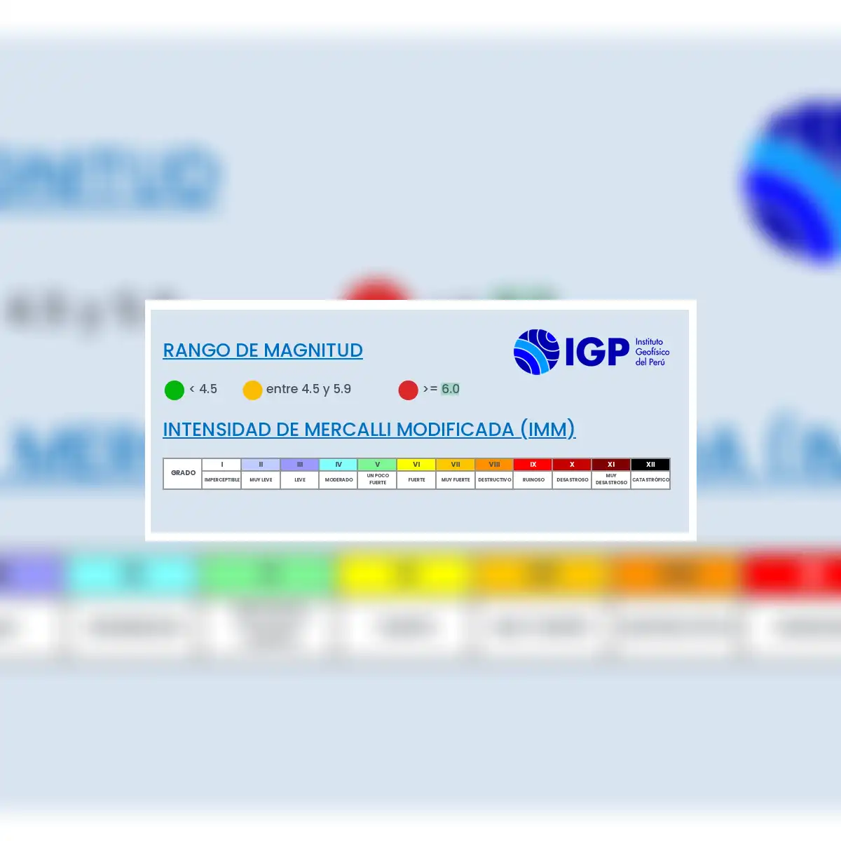
To evaluate seismic events, the Geophysical Institute of Peru employs two distinct monitoring systems. One system measures the physical acceleration of the ground, while the second uses the Modified Mercalli scale to rate surface impact and perceived shaking.
The Modified Mercalli scale ranges from degree I to degree XII. Higher values on the scale indicate greater destruction to residential housing, public infrastructure, and human communities following a quake.
Ground acceleration measurements provide a direct physical calculation of how violently the subsoil shakes, expressed in centimeters per second squared. Tavera pointed to historic seismic events to illustrate how these metrics reflect real world intensity.
During the 2007 earthquake in Pisco, monitoring instruments recorded ground acceleration levels between 240 and 300 centimeters per second squared. By comparison, the 2010 earthquake in Chile registered acceleration levels reaching up to 800 centimeters per second squared.
In a recent seismic movement felt in Lima, ground acceleration readings showed moderate shaking. Tavera confirmed that the movement did not cause major structural damage across the Peruvian capital.
National Preparedness and Upcoming Drills
Emergency management authorities in Peru are preparing for the Second 2026 National Earthquake Drill, designated as II Simulacro 2026. The national exercise is designed to test emergency responses against a simulated magnitude 8.8 earthquake.
Disaster response models estimate that a hypothetical magnitude 8.8 earthquake off the Peruvian coast would result in more than 10,000 deaths. Official projections also indicate that such a catastrophic event would leave 3.8 million people affected across impacted regions.